Licensed Identification Survey
A fence is not a boundary. This is a concept that many people struggle with. A fence is simply a physical structure to provide privacy between lots, which in most cases is located in the general vicinity of the true boundary position (cadastral boundary). Was a Licensed Surveyor engaged to define / establish the position of the cadastral boundary before the fence was originally erected?
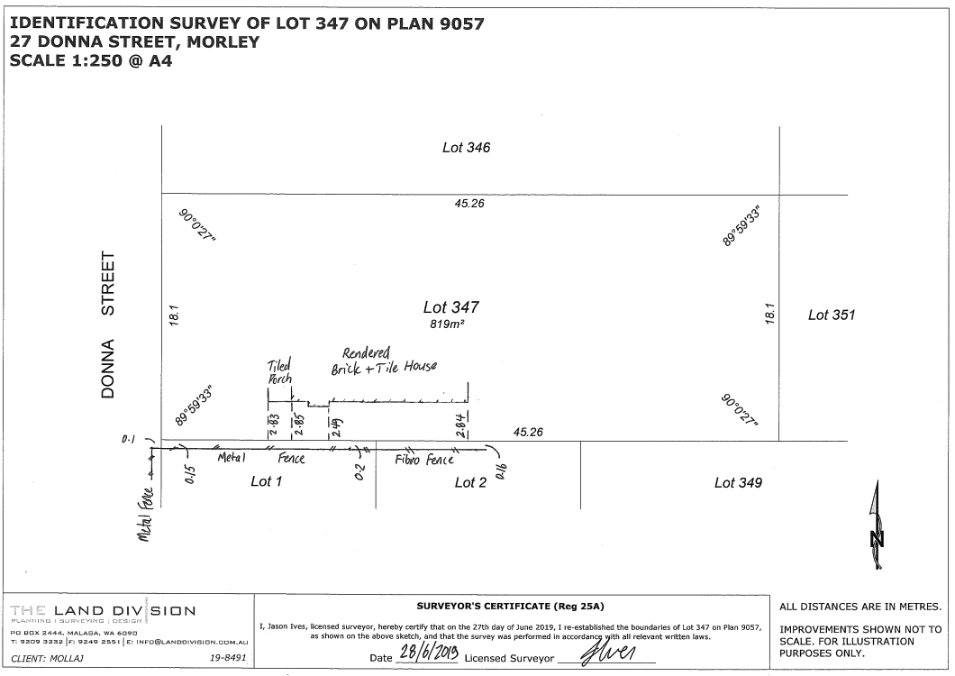
Example
A client had entered into a contract to purchase a property and advised that the measurement (by tape) was 3.05m between the side wall of the house they wished to retain and the fence (the minimum access leg requirement for a subdivision is 3m).
Where a tape measurement is less than 3.20m we recommend a Licensed survey to determine the true separation from the boundary (in most instances fences are located within 0.2m of a boundary).
Type of Survey
Surveyors do not need to physically install a survey mark (typically wooden peg) in order to determine a true boundary position. This type of survey is referred to as a boundary reestablishment (re-peg) survey.
If the purpose is to determine the true separation between a house wall and the side boundary we recommend a Licensed ‘Identification Survey’ (basically a re-peg survey without physically installing survey marks and therefore slightly cheaper).
Result
Our survey (see plan overleaf) found that the subject wall was located 2.83-2.85m from the side boundary and that the side fence was out of position by ~0.15m-0.2m (thus why the client measured 3.05m).
Our client was not comfortable with the risk of future subdivision being refused and therefore did not proceed with the purchase of the property.
Get In Touch With Us Today
Fill out our contact form and our team will get back to you